Why Choose an Industrial Quadcopter for Your Business?
FLUID HANDLING EXPERTS

Blog, all our news

Why Choose an Industrial Quadcopter for Your Business?

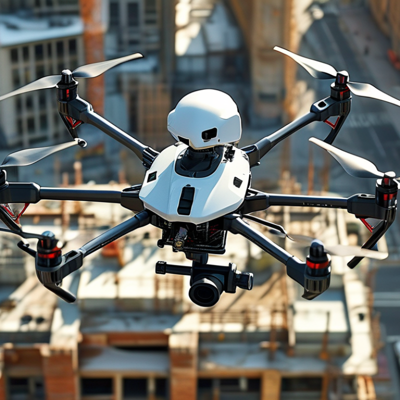
Choosing an Industrial Quadcopter can change how a business observes assets, measures risk, and responds to costly problems. It is not simply a flying camera. It is a field tool that combines accurate sensors, stable flight, and actionable data.

On a construction site, one aircraft can inspect roof sections before workers climb ladders. On a farm, it can reveal dry crop patches through multispectral imaging. In a warehouse, it may scan high structures without interrupting daily operations. These details can reduce inspection time and improve maintenance planning.

The equipment still demands careful judgment. Weather, battery limits, signal strength, and operator training affect every mission. Some businesses buy advanced drones before defining a useful workflow. That is an expensive mistake. The best platform should match the site, payload, software, and reporting process.

Colin Snow, founder of Drone Analyst, has said, “The value of a drone is not in the drone itself, but in the data it collects.” This principle remains highly practical. A capable Industrial Quadcopter matters only when its information supports safer decisions, clearer records, or measurable savings.

Consider the entire operation. Who prepares the flight plan? Who reviews the images? Who acts on the findings? Weak answers expose hidden costs. Strong answers create repeatable value.

This guide examines those questions closely. It also recognizes an uncomfortable truth: drones cannot fix poor processes. They can expose them.
Why Choose an Industrial Quadcopter for Your Business?

Defining Industrial Quadcopters: 2–10 kg Payloads and 20–50-Minute Flights

An industrial quadcopter is built for measurable work, not casual photography. Its practical definition often includes a 2–10 kg payload and 20–50-minute flight time. Payload means usable cargo after accounting for the aircraft, batteries, and safety equipment. That distinction matters. A 10 kg lifting claim may apply only in calm, controlled conditions. Wind, temperature, altitude, and battery age can reduce capacity quickly.

Grand View Research valued the global commercial drone market at approximately USD 30.61 billion in 2023. It also forecasts a 13.9% compound annual growth rate from 2024 to 2030. Drone Industry Insights’ 2024 Commercial Drone Market Report identifies inspection, mapping, and logistics as major growth areas. These tasks require stable lifting performance and repeatable endurance. A 20-minute flight may support a short site check. A 50-minute flight can reduce battery changes across larger facilities.

Field testing should use the full payload, not an empty-aircraft figure. Operators should record wind speed, takeoff weight, battery cycles, and return reserves. The advertised range is only a starting point. In practice, a quadcopter carrying 2 kg may fly very differently from one carrying 10 kg. That gap is easy to overlook. It deserves honest testing before purchasing.

Why Choose an Industrial Quadcopter for Your Business? - Defining Industrial Quadcopters: 2–10 kg Payloads and 20–50-Minute Flights

Representative operating ranges for industrial quadcopters; actual performance varies with payload, battery, weather, altitude, and mission configuration.
Specification or Business Factor Typical Range or Capability Why It Matters to a Business
Payload capacity Approximately 2–10 kg Supports professional cameras, LiDAR units, multispectral sensors, loudspeakers, spotlights, and compact delivery loads.
Flight endurance Approximately 20–50 minutes per battery cycle Provides enough time for inspection routes, mapping passes, emergency assessment, or repeated lifting operations before landing to recharge or change batteries.
Payload-to-endurance trade-off Higher payload generally reduces flight time Mission planning can balance sensor weight, battery capacity, route length, and required reserve power.
Typical takeoff mass Roughly 8–30 kg, including battery and payload The aircraft is large enough for heavier equipment but remains more compact and maneuverable than many heavy-lift multirotors.
Motor and rotor configuration Four motors and four rotors; often with redundant flight-control and power-monitoring systems The simple airframe can reduce mechanical complexity, maintenance points, and transport requirements compared with larger rotor configurations.
Wind operating capability Commonly designed for approximately 8–12 m/s sustained wind, depending on configuration Improves the reliability of outdoor inspections and surveys, although operators must still follow site-specific weather limits.
Weather protection Many professional systems offer rain and dust protection; commonly expressed through an IP rating Helps protect electronics during field work, but an IP rating does not automatically mean the aircraft is safe to operate in every rainfall condition.
Sensor integration Gimballed RGB cameras, thermal cameras, LiDAR, multispectral cameras, and zoom payloads One aircraft can support multiple workflows, including asset inspection, surveying, vegetation analysis, public safety, and progress documentation.
Positioning and navigation GNSS-assisted flight, inertial navigation, altitude sensing, and obstacle detection on many systems Supports repeatable routes, stable hovering, automated mapping, and safer operation near structures when properly configured.
Data and communications Digital command links with live video and telemetry; practical range depends on regulations and local radio conditions Enables real-time supervision, rapid decision-making, and immediate quality checks during field operations.
Operational efficiency Rapid deployment with fewer ground resources than many traditional inspection methods Can reduce work-at-height exposure, traffic disruption, inspection time, and the need for scaffolding or heavy access equipment.
Best-fit business applications Power-line and infrastructure inspection, construction surveying, mining, agriculture, emergency response, and industrial site monitoring The combination of lift capacity, endurance, and sensor flexibility makes the platform suitable for recurring, data-intensive field missions.
Compliance and safety planning Requires trained operators, airspace checks, maintenance records, risk assessments, and compliance with local aviation rules A compliant operating program protects personnel, assets, collected data, and the continuity of commercial operations.

Evaluating Flight Performance: Hover Stability, Range, and Wind Resistance

Why Choose an Industrial Quadcopter for Your Business?

Flight performance often decides whether an industrial quadcopter saves time or creates another operational problem. In field testing, hover stability is easy to notice. A reliable aircraft should hold position near a roof edge, tower, or inspection point without constant control corrections. Small movements still matter when a camera must capture clear bolts, cracks, or thermal differences. Satellite signal quality, payload weight, and battery condition can affect this performance. We have found that a stable hover is not always perfect in every location.

Range requires more than reading the advertised maximum distance. Buildings, terrain, radio interference, and local operating rules may reduce practical coverage. A useful test measures the return journey, not only the outward flight. Wind resistance deserves similar caution. A quadcopter may remain controllable in moderate wind, yet its battery can drain faster while fighting gusts. During a rooftop inspection, sudden airflow around walls can feel stronger than the general forecast. That detail is easy to underestimate.

Tips: Test the aircraft with its actual payload. Record hover drift, signal strength, battery usage, and landing accuracy. Repeat tests on calm and windy days. Leave a safe reserve for the return flight. Do not rely on one successful demonstration. Safety margins often reveal more than impressive specifications. Expect occasional imperfect data, and investigate why.

Measuring Data Quality: Centimeter-Level RTK Accuracy and 4K Imaging

An industrial quadcopter earns its place through measurable data quality, not impressive flight time alone. RTK positioning can reduce horizontal error to roughly 1–3 centimeters under suitable conditions. The numbers still need testing.

The USGS 3DEP Lidar Base Specification, Version 2.1, uses 10-centimeter RMSEz for key elevation products. That benchmark shows why survey teams should inspect ground control, satellite visibility, and correction links. ASPRS Positional Accuracy Standards also require reporting accuracy with confidence levels, rather than relying on a single attractive figure. In practice, buildings, trees, and radio shadows can weaken RTK performance. A field log should record fix status, correction age, satellite count, and checkpoints.

Sharper images help interpretation. A 4K camera produces 3,840 × 2,160 pixels, as defined in ITU-R BT.2020. Yet 4K does not guarantee useful measurements. Flight height, lens distortion, shutter speed, and lighting determine ground sampling distance. A cracked roof may fill several pixels in one flight, then disappear in another. Operators should compare a visible scale marker with surveyed checkpoints. That extra step feels slow. It prevents confident-looking mistakes. Data quality is a chain, and the weakest link often appears after landing.

Ensuring Safe Operations: FAA Part 107’s 400-Foot Altitude Limit

Why Choose an Industrial Quadcopter for Your Business?

Industrial quadcopters can support inspections, mapping, site surveys, and infrastructure monitoring. Their value depends on disciplined operation, not impressive specifications alone. Under FAA Part 107, the standard altitude limit is 400 feet above ground level. Near a structure, the aircraft may fly within 400 feet of that structure, when the rule’s conditions are met.

That limit affects daily planning. A pilot should measure the planned height from the ground below the aircraft, not simply from the launch point. Uneven terrain can create unexpected altitude differences. A preflight checklist should review elevation, nearby obstacles, weather, airspace status, and the aircraft’s altitude settings. Keep the aircraft within visual line of sight. Small errors matter.

Wind can also push a quadcopter toward cranes, towers, or restricted areas. Field teams should maintain conservative buffers instead of treating 400 feet as a target. FAA authorization may be required for certain airspace operations, and applicable rules can change. Verify current requirements before each mission.

Experience teaches humility. A clear flight log does not prove every decision was perfect. Operators should record deviations, battery performance, visibility changes, and unusual site conditions. That information improves future planning. The safest business workflow combines trained remote pilots, reliable checklists, accurate records, and a willingness to stop when conditions become uncertain.

Why Choose an Industrial Quadcopter for Your Business?

Ensuring Safe Operations: FAA Part 107’s 400-Foot Altitude Limit

Under FAA Part 107, small unmanned aircraft generally must remain at or below 400 feet above ground level (AGL). When operating near a structure, the aircraft may fly up to 400 feet above the structure’s immediate uppermost limit, provided the applicable conditions are met. Industrial quadcopters can support safer business operations by helping teams plan inspections, surveys, and monitoring missions within these limits.

Calculating Business ROI: Labor Savings, Downtime Reduction, and Asset Coverage

Industrial quadcopters can turn routine inspections into a measurable business investment. A trained operator may survey a warehouse roof in 30 minutes, rather than sending two workers outside for several hours. Labor savings become clearer when mileage, ladders, access equipment, and reporting time enter the calculation. Record the old inspection cost, then compare it with flight time, staffing, maintenance, and data processing.

Downtime reduction often creates the strongest return. Aerial images can reveal loose panels, blocked vents, heat patterns, or standing water before a small fault interrupts production. One avoided shutdown may repay months of inspection costs. Asset coverage matters too. A single flight can document roofs, storage yards, solar arrays, and distant equipment with consistent visual records. Still, estimates can be too optimistic. Weather, battery limits, training gaps, and poor image quality may reduce actual savings. Pilot projects expose these weaknesses.

Tips: Track labor hours before and after each inspection. Assign a value to one hour of downtime. Include equipment upkeep and software costs. Compare findings with ground inspections. Keep assumptions visible. That makes the ROI credible, even when the numbers disappoint.

Copyright 2025 Fluidra S.A. | Created by BCM Marketing Agencia Privacy Policy Legal note | Cookie policy |

Technical cookies are strictly necessary for our website to work and you can navigate through it. These types of cookies are those that, for example, allow us to identify you, give you access to certain restricted parts of the page if necessary, or remember different options or services already selected by you, such as your privacy preferences. Therefore, they are activated by default, your authorization not being necessary in this regard. Through the configuration of your browser, you can block or alert the presence of this type of cookies, although such blocking will affect the proper functioning of the different functionalities of our website.


The analysis cookies allow us to study the navigation of the users of our website in general (for example, which sections of the page are the most visited, which services are used most and if they work correctly, etc.). From the statistical information on navigation on our website, we can improve both the operation of the page itself and the different services it offers. Therefore, these cookies do not have an advertising purpose, but only serve to make our website work better, adapting to our users in general. By activating them you will contribute to this continuous improvement. You can enable or disable these cookies by checking the corresponding box, being disabled by default.


Functionality cookies allow us to remember your preferences, to personalize certain characteristics and general options of our website, every time you access it (for example, the language in which the information is presented to you, the sections marked as favorites, your browser type, etc.) Therefore, this type of cookies does not have an advertising purpose, but by activating them you will improve the functionality of the website (for example, adapting to your type of browser) and the customization of it based on your preferences (for example, by presenting the information in the language that you have chosen in previous occasions), which will contribute to the ease, usability and comfort of our page during your navigation. You can enable or disable these cookies by checking the corresponding box, being disabled by default.


Advertising cookies allow us to manage the advertising spaces included in our website based on criteria such as the content shown or the frequency in which the ads are displayed. For example, if you have been shown the same ad several times on our website, and you have not shown a personal interest by clicking on it, it will not appear again. In summary, by activating this type of cookies, the advertising shown on our website will be more useful and diverse, and less repetitive. You can enable or disable these cookies by checking the corresponding box, being disabled by default.


Behavioral advertising cookies allow us to obtain information based on the observation of your browsing habits and behaviors on the web, in order to show you advertising content that best suits your personal tastes and interests. To understand it in a very simple way, we will give you a fictitious example: if your last searches on the web were related to suspense literature, we would show you advertising about suspense books. Therefore, activating this type of cookies, the advertising that we show you on our website will not be generic, but will be oriented to your searches, tastes and interests, therefore adjusting exclusively to you. You can enable or disable these cookies by checking the corresponding box, being disabled by default.
To understand it in a very simple way, we will give you a fictitious example: if your last searches on the web were related to suspense literature, we would show you advertising about suspense books. Therefore, activating this type of cookies, the advertising that we show you on our website will not be generic, but will be oriented to your searches, tastes and interests, therefore adjusting exclusively to you. You can enable or disable these cookies by checking the corresponding box, being disabled by default.

SAVE

We use our own and third-party cookies to ensure the proper functioning of the website and to analyse our services, improve your experience on our website and show you advertisements related to your interests according to profiling based on your browsing habits (e.g. websites visited). You can accept all cookies by clicking "ACCEPT" or set or reject them by clicking here. If you would like to know more about the use of cookies, please see our COOKIE POLICY.


ACCEPT ALL
Reject no essentials